Introduction
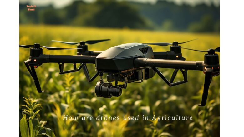
The present age is the age of science. We cannot do even a single day without science and technology. Science has simplified our life. We use science and technology in almost every sector of our life. It has invented many valuable technologies and devices. A drone is one of them. It is one of the greatest blessings of modern science and technology. Today, people utilize drones in many sectors. Agriculture is one of them. Drones play a very vital role in agriculture. But we should know properly how are drones used in agriculture to get the most benefits in the agricultural arena. In the contemporary world, drones can significantly assist in addressing the shortage of agricultural products, provided that we utilize them appropriately.
What is a drone?
A drone is one kind of aircraft that can fly without a human pilot. It is an unmanned aerial vehicle (UAV) or unmanned aircraft system. Basically, a drone is a flying robot that one can control remotely, or it can fly automatically with its pre-programmed routes. It uses sensors and GPS for navigation.
Unmanned Aerial Vehicles (UAVs) are mostly known for their military applications. They were first used for anti-aircraft training, intelligence collections, and, in some cases, as weapon platforms. The military used to utilize drones for tasks that were too dangerous for human pilots in manned planes. But civilians use drones for various professional and recreational activities, which include the following:
- Personal use
- Search & Rescue
- Surveillance
- Weather Monitoring
- Traffic monitoring
- Fire suppression activities
- Aerial photography utilizing drones
- Videography
- Agriculture
- Delivery services
How does a drone work?
Drones use a combination of hardware and software to fly. They usually have rotors, propellers, or fixed wings, plus sensors and cameras. Moreover, we also include navigation tools like GPS and gyroscopes to help keep them stable while flying.
Additionally, the ground control station (GCS), payload, and data links are important parts of drone technology. The GCS includes both hardware and software that can permit operators to talk to the drone from the ground. The users can manage the GCS directly or use satellites for operation. Drones can transport various kinds of payloads, like medical supplies or packages from Amazon. Data links are important for the drone to communicate with the ground operator while flying.
How are drones utilized in the field of agriculture?
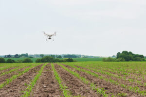
What Do Agriculture Drones Do?
Agriculture drones have many uses in farming. They mainly support farmers to watch over their crops in real-time. By taking aerial photos or videos of large fields, the farmers can find out potential problems early and can stop them from becoming bigger issues. This early action assists them in improving farming methods, and it leads to better production and income.
The use of drones in agriculture has reduced labor costs compared to traditional cultivation methods. They decrease the necessity for manual work in spotting pests and diseases, checking soil differences, measuring water levels, and determining fertilizer requirements. Some ultra-model drones have sensors to monitor light, temperature, soil pH, and other important aspects of plant health.
AG drones not only help real-time crop monitoring but also implement various other functions, including crop spraying and seeding activities. Normally, these jobs take a lot of time and workers, but using UAVs makes them faster and more efficient.
Moreover, these drones supply accurate precision when distributing pesticides or fertilizers on crops. In this way, it removes any inefficiency resulting from traditional spraying techniques. In addition, drones with GPS technology enable farmers to monitor the precise location of each seed sown, simplifying the task of monitoring crop growth progress.
Why use drones in agriculture?
In recent decades, drones have improved significantly. In the agricultural sector, they have revolutionized farming by offering farmers lower costs, better efficiency, and higher profits.
The use of drones in contemporary agriculture has brought about a significant transformation by helping farmers manage their crops and animals more effectively. As food demand increases and climate change poses new challenges, drones provide an advanced way to monitor, assess, and improve agricultural practices. Drones provide important information about weather conditions. This article will look at the various ways drones are reshaping farming.
Here in this article, we will explore how drones are improving the agricultural field. They make agriculture more modern, productive, and profitable than ever. We will examine the merits of drones for farmers and the specific types of data they collect on the farm, which supports crop spraying, checking soil and crop health, and managing irrigation requirements.
Types of Drones Used in Agriculture
Fixed-Wing Drones
These drones are similar to airplanes and can cover broad areas quickly. For mapping large fields, fixed-wing drones are particularly effective.
Multirotor Drones
Multirotor drones possess greater quickness and can hover in a fixed position, which makes them ideal for executing thorough inspections of confined spaces.
Hybrid Drones
Hybrid drones, which combine both fixed-wing and multirotor designs, provide the benefits of each type, thereby enhancing versatility for a range of agricultural activities.
The Benefits and Application Process of Using Drones in Agriculture
Increased Efficiency
Drones can quickly and accurately scan large farming areas, which lessens the time and labor involved in traditional crop monitoring. This saves time and lowers labor costs, allowing farmers to focus on other important tasks.
Cost-Effectiveness
Although there is a cost to start using drones, they can save money on operations over time. Early detection of problems like water stress or pest infestations allows farmers to prevent crop damage and enhance their yield.
Precision Agriculture
Drones play a vital role in precision agriculture. They collect data using GPS and high-resolution images and assist farmers in handling soil health, crop conditions, weather, water, fertilizers, and pesticides more effectively. This reduces waste and encourages the growth of healthier crops.
Role of Drones in Soil Analysis
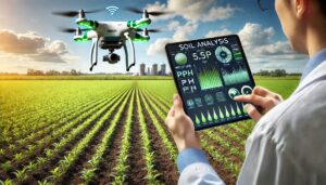
Drones have the capability to collect information about the composition and health of soil, which assists farmers in gaining insights into ways to enhance their soil for increased crop production.
The soil analysis process using drones includes several key steps:
1. Planning: Identify the area to be surveyed, select the appropriate drone and sensors (such as multispectral or thermal), and check that the weather and regulations are favorable.
2. Data Collection: The drone flies over the area, capturing images and data with sensors that assess soil moisture, nutrient content, and texture.
3. Data Processing: The collected images are combined, and software analyzes the information to produce detailed maps that highlight differences in soil characteristics like moisture, fertility, and compaction.
4. Analysis and Reporting: Specialists review the data, prepare a report, and provide suggestions for enhancing soil and crop management.
5. Action and Monitoring: Farmers apply this data for precision agriculture, and drones can keep track of soil changes over time.
This approach improves farming methods, boosts crop yields, and minimizes environmental effects.
Application of Fertilizers and Pesticides
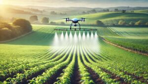
Farmers can utilize data gathered by drones to apply fertilizers and pesticides selectively, targeting only the areas that require treatment. This approach minimizes the use of chemicals and contributes to cost savings.
Using drones for fertilizer and pesticide application includes several important steps:
1. Mapping the Field: Drones use GPS and sensors to create accurate maps of the area.
2. Filling Up: Fertilizers or pesticides are prepared and placed in the drone’s tank.
3. Setting Up: The drone’s flight route and application amounts are programmed according to a map.
4. Spraying: The drone automatically applies the fertilizer or pesticide, targeting specific spots.
5. After the Flight: Data is gathered, and the area covered is checked.
6. Cleaning and Checking: The drone is cleaned and inspected for its next use. This method promotes effective, accurate, and eco-friendly applications.
Irrigation Management Using Drones
Successful farming relies on effective water management, and drones provide an accurate method for monitoring irrigation systems.
Monitoring Water Distribution
Drones have the capability to survey agricultural fields to identify regions that are either excessively or insufficiently irrigated, thereby assisting farmers in making necessary adjustments to their irrigation systems.
How to apply Drones for Water Distribution:
Farmers utilize drones to deliver water accurately and effectively. The process begins with mapping the land and pinpointing spots that require watering. Drones fitted with water tanks or spraying equipment fly over the fields on a set path and distribute water uniformly. They can modify their flight routes and water output using real-time sensor data.
Once the irrigation is complete, drones gather information to verify proper water distribution and make necessary adjustments. This technique saves time, minimizes water waste, enhances crop health, and reduces labor and expenses.
Detecting Moisture Levels in Soil
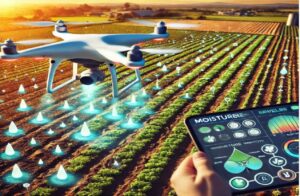
Drones are able to use thermal cameras to assess moisture levels in the soil, guaranteeing that crops receive the appropriate amount of water.
Here’s a simplified overview of how to use drones to check soil moisture in farming:
1. Flight Planning: Evaluate the location, choose the area to study, and design a flight plan with special software to set the route and height.
2. Choosing Sensors: Pick the right sensors, like multispectral cameras for plant health, thermal cameras for temperature, and LiDAR for mapping the land.
3. Launching the Drone: Send the drone on the planned path to gather real-time data while following safety rules.
4. Data Processing: Analyze the images collected to create detailed maps and use algorithms to link the data to soil moisture levels.
5. Moisture Mapping: Create maps that show moisture levels in the field, marking areas with high and low moisture.
6. Making Decisions: Use these moisture maps to manage irrigation, plan crops, and monitor conditions to use resources wisely.
7. Reporting Findings: Write reports that summarize the results and suggestions, and keep records for future use.
8. Ongoing Improvement: Set up a system to improve methods based on how well moisture management works and the data collected later.
This method of using drones improves precision in farming, leading to better decisions and resource management for higher crop yields and sustainability.
How Drones Improve Crop Monitoring
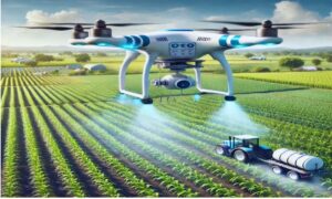
One significant application of drones in the agricultural sector is the real-time monitoring of crops. This technology enables farmers to obtain an aerial perspective of their fields, allowing them to identify problems that might not be apparent from ground level.
Real-Time Monitoring
Farmers can gain insights into plant health and potential problem areas by using drones to continuously monitor crop conditions.
Early Detection of Crop Diseases
Drones equipped with specialized sensors and cameras are capable of identifying indicators of crop diseases prior to their proliferation, thereby facilitating prompt intervention.
Steps for Detecting Crop Diseases Using Drones
1. Planning Before Flight: Farmers create a map of the field and choose the right sensors (RGB, multispectral, thermal).
2. Launching Drones: Drones fly over the field, taking images or videos of the crops with the selected sensors.
3. Data Collection & Storage: Data is sent in real-time or saved for future analysis.
4. Analyzing Data: AI tools and methods like NDVI and thermal imaging examine the data for signs of crop stress or illness.
5. Identifying Diseases: Problem areas are located, and potential diseases are diagnosed through pattern recognition.
6. Follow-Up Actions: Detailed reports help farmers apply specific treatments to the affected areas.
7. Ongoing Monitoring: Drones consistently check crops for early detection and prevention.
8. Integration with Farm Management: Data is incorporated into farm systems for better crop management.
This method allows for quick detection of diseases and enhances crop health.
Measuring Plant Health
Farmers can use drones with multispectral sensors that can analyze factors such as chlorophyll levels in order to assess plant health and obtain detailed data for optimizing their farming practices.
The Process of Measuring Plant Health by Drones:
Using drones to measure plant health in agriculture means employing drones with sensors to keep an eye on crops. First, we need to choose the appropriate drone and sensors, like multispectral, thermal, or RGB cameras. Then we have to make a flight plan, and the drone flies over the field to gather images and data. After that, we should analyze this information to produce detailed maps, including vegetation indices like NDVI, which help evaluate plant health. Farmers can use these findings to spot issues, such as water shortages or diseases, and apply specific treatments, making better use of resources and enhancing crop yields through ongoing monitoring.
How Drones Help in Crop Spraying
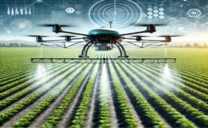
Now modern farmers are using drones for crop spraying, which are replacing the inefficient and labor-intensive traditional methods.
Using drones for crop spraying in farming includes several important steps:
1. Choose the Right Drone: Pick an agricultural drone that can carry enough weight and has good flight time.
2. Prepare the Field: Examine the field to create a map and find any trouble spots.
3. Mix and Load Chemicals: Get the pesticide or fertilizer ready and fill the drone’s tank.
4. Plan the Flight Path: Use software to determine the drone’s route, altitude, speed, and spray amount.
5. Pre-flight Check: Check the drone, look at the weather, and ensure everything is safe.
6. Launch the Drone: Operate the drone along the set path to spray the crops.
7. Monitor Operation: Observe the spraying in real time and make adjustments if necessary.
8. Post-flight Tasks: Land the drone, clean it, and analyze the spray data.
9. Maintenance: Recharge the batteries and carry out regular maintenance on the drone.
10. Legal Compliance: adhere to local laws and keep records of the spraying activities. This method improves efficiency and accuracy and minimizes chemical waste in farming.
Drones for Livestock Management
Drones extend beyond agricultural applications even more; they are also valuable in livestock management, offering an aerial perspective on the health and positioning of animals.
Herd Tracking
Drones can easily monitor the large herds of livestock to make sure they remain within specific areas.
Identifying Animal Health Issues
Drones equipped with thermal imaging technology can detect indications of illness or injury in livestock, facilitating prompt medical intervention.
Drones for Planting Seeds
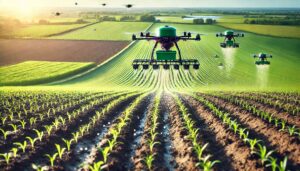
Certain sophisticated drones have technology that plants seeds, consequently enabling them to sow seeds more rapidly and efficiently compared to conventional techniques.
Using drones for planting seeds in farming is a fast and accurate method that includes several important steps:
1. Field Analysis and Planning: Drones scan the field to check soil health and landscape and create a map for planting.
2. Drone and Seed Setup: We have to place seeds in drones that have systems for spreading seeds. Then we ought to modify the drone settings according to the type of seeds and planting designs.
3. Automated Seeding: Drones fly over the area, dropping seeds at exact spots based on set paths.
4. Monitoring after planting: Drones keep an eye on seed growth and crop development, helping to spot problems early.
5. Ongoing Care: Drones may require refilling and charging, and changes can be made based on the condition of the crops.
This approach speeds up the process, cuts down on labor, and ensures the accurate placement of the seeds for the best growth.
Automated Spraying Technology
Automated systems enable drones to distribute pesticides or fertilizers uniformly over agricultural fields, thereby minimizing human error and limiting exposure to hazardous chemicals.
Benefits of Drone-Based Spraying
Spraying with drones is quicker, more accurate, and can be carried out as needed, resulting in improved crop health and decreased chemical usage.
Overview of Drone-Based Planting
Farmers can drop seeds into the soil by drones at specific intervals, guaranteeing uniform distribution and quicker planting.
How it Improves Seed Planting Efficiency
Drone planting offers increased speed, lowers labor expenses, and is capable of accessing regions that are challenging to reach by hand.
Mapping and Land Surveying with Drones
Drones are ideal for conducting detailed surveys and creating maps of extensive agricultural land, offering in-depth information about the topography.
Drones are becoming popular in agriculture for mapping fields and surveying land effectively. The process includes several important steps:
1. Preparation and Planning: Set goals, evaluate the land, and check regulations.
2. Drone Selection: Pick a drone with suitable features, like multi-spectral cameras for checking crop health and GPS for precise mapping.
3. Flight Planning: Use software to create the flight path, determine altitude and speed, and conduct safety checks.
4. Data Collection: Flying over the area, the drone gathers images and sensor data.
5. Data Processing: After the flight, the software combines images into maps and aligns them for accuracy.
6. Analysis: The processed data reveals information about crop health, land shape, and irrigation methods.
7. Decision-Making: Farmers use this data to modify farming techniques, enhancing efficiency and crop production.
8. Reporting: Findings are presented as maps and reports for ongoing monitoring.
9. Post-Survey Actions: Make necessary changes and schedule follow-up surveys to assess progress. Drones provide accurate, affordable, and efficient agricultural surveys, aiding in better resource management and sustainability.
Creating Topographic Maps
Drones are capable of producing three-dimensional topographic maps of agricultural lands, which assist farmers in optimizing their strategies for irrigation, planting, and harvesting.
3D Mapping of Farms
Advanced drones are capable of producing intricate three-dimensional models of agricultural land, facilitating improved planning and resource management.
Data Collection and Analysis
Drones gather massive amounts of data, which analysts use to make informed decisions for farming.
Sensors and Cameras Used in Drones
Drones come with a variety of sensors and cameras, such as multispectral and thermal, for collecting different kinds of data.
How Data is Processed for Actionable Insights
The information gathered by drones is processed through advanced software, providing farmers with practical insights to enhance their agricultural practices.
Challenges of Using Drones in Agriculture
While drones offer numerous advantages, there are certain obstacles associated with their implementation in agriculture.
Regulatory Challenges
It’s challenging for farmers to freely use drones. That’s why many countries have stringent regulations on their use.
High Initial Investment
Although drones have the potential to reduce expenses over time, the initial investment can be substantial, particularly for farmers operating on a small scale.
Need for Skilled Operators
Operating drones necessitates specialized training, and not all farmers possess the requisite skills or resources to undertake this task.
The Future of Drones in Agriculture
Drones will play an increasingly prevalent role in agriculture, as promising developments are on the way.
Potential Advancements
In the future, experts anticipate that drones will achieve full autonomy. That will enable them to carry out the functions of planting, spraying, and monitoring independently of human oversight.
Integration with AI and Robotics
The integration of AI and robotics with drones is expected to enhance farming solutions. These advancements will offer advanced capabilities. They will include predictive analysis and fully automated farms.
Final Thoughts
In fine, we can say that Drones are beginning to revolutionize agricultural practices, and their possibilities are boundless. Here in this article, the process of how are drones used in agriculture has been shown. Through precision farming and immediate monitoring capabilities, drones assist farmers in maximizing their resources and enhancing crop yields. With ongoing technological advancements, the future of drones in agriculture appears promising, featuring increased automation and the integration of artificial intelligence. Drones are becoming more and more essential in the agricultural sector.




I like your storytelling style- it makes the article informative and enjoyable to read. Science and technology is blessing for our daily life. Use of drones in agriculture is a surprising invention which makes our life more easy
Wow! Very helpful article for digital farmers.